About
Our project aims to create a model of the subsurface to better understand seismic hazards associated with the Cascadia Subduction Zone. To do this, we would install temporary seismic stations in the Coast Ranges of Oregon and Washington. The seismometers would record continuously, providing records of ground motion from earthquakes, background noise, and any other signals that occur during the deployment period. We also hope to coordinate with other researchers to record offshore signals generated by a research ship. Offshore signals would be detected onshore only by very sensitive seismometers, and would not be felt by humans or animals or damage natural or man-made structures. Computer processing of the seismic signals would allow us to generate an image of the subsurface geology to a depth of ~40 km (25 miles) using mathematical techniques similar to those used in medical imaging.
Update February 10, 2021: The Cascadia experiment is planned for early summer 2021. We are now recruiting field volunteers.

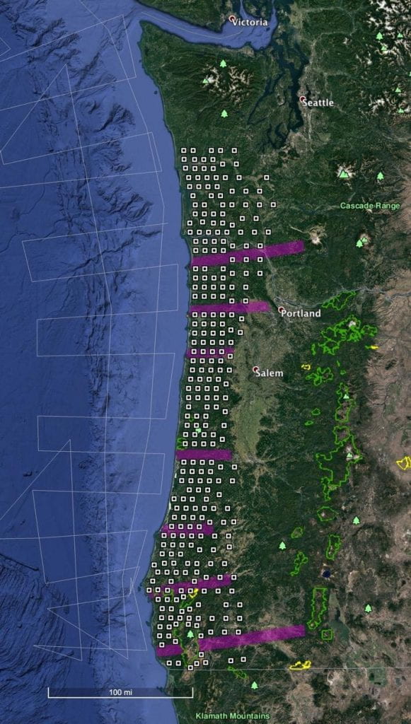
Schematic of the deployment pattern: white squares represent a grid of seismic stations spaced 10-15 km (6-10 miles) apart. The magenta lines are linear arrays of stations at 1 km (0.6 mile) intervals
A field program organized by scientists from Oregon State University, the University of Oregon, the South Dakota School of Mines & Technology, and the United States Geological Survey.
For more information, please contact anne.trehu@oregonstate.edu, emilie@uoregon.edu, kevin.ward@sdsmt.edu, or ewirth@usgs.gov.