Instrumentation
We plan to use two different types of seismic recorders. Systems in which a data recorder and deep-cycle battery are attached to a seismic sensor (Type A) would form the backbone of the grid. The sensor would be installed in a shallow hole located ~2 yards from the rest of the instrumentation, which would be above ground in a plastic case. In some cases, there would also be a small solar panel to recharge the battery. For the linear arrays, we would use smaller instruments that are entirely self-contained (Type B). They can either be buried or sit on the surface and coupled to the ground with small spikes. All holes would be dug by hand to a depth of ~12” or less and would be filled after the instruments are retrieved.
The instruments would be installed during the last 2 weeks of May and removed in late June and early July. We would drive to sites on established vehicle access routes and walk to off-road sites. Sites would be on private land, as well as land managed by Native American tribes and by local, state, and federal entities. Permission for all sites would be obtained from the relevant authorities, and we do not plan any installations in federal wilderness areas (outlined in green on the map) or national parks. We are in the process of collecting information on land ownership and contacting owners to obtain the necessary permits. Seismometer deployments would be conducted in compliance with any federal, state, and local environmental laws.
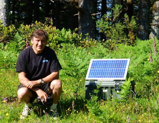
Instrument type A: The recorder and battery are in the green plastic case and connected to a small solar panel. The sensor is approximately 4”x2”x4” and is buried up to 12” deep near the recording package. If the ground is too rocky for burial or if other considerations preclude burial, then soil or sand could be used to cover it. Instruments would be located out of sight of the road as much as possible.
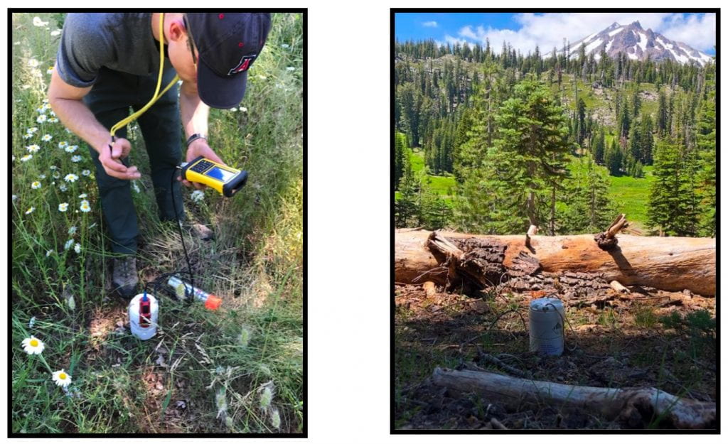
Instrument Type B: The entire instrument (sensor, recorder and power supply) is in a single self-contained small case that would be installed either on the ground surface with short spikes to couple it to the subsurface or buried in a shallow hole. These instruments, which are smaller, lighter, and easier to install, represent a new generation in portable seismometer technology.